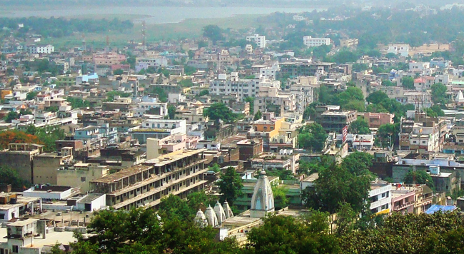
CITY TOPOGRAPHY
Ranchi is very famous for its wide natural beauty, hospitality and tribal culture giving a genuine lifetime experience to the visitors. Wide Dense forest areas surrounding Ranchi City which add to its natural attraction. Ranchi lies at 23.35°N latitude & 85.33°E longitude. The total municipal area of the district is 175.12 square kilometres. The average elevation is 651 m /2140 feet above sea level.
The Ranchi city is located in the southern part of the Chota Nagpur Plateau. The main river system is Subarnarekha, South Koel and its tributaries. Dams have been developed on the channels Rukka, Kanke and Hatia to create reservoirs which supply water to the city’s population. There are many beautiful waterfalls in and around Ranchi, like Dassam Falls, Hundru Falls, Hirni Falls, Jonha Falls and Panchghagh Falls, thus it is also called the "City of Waterfalls." These add to the scenic beauty of the region.
Ranchi has a hilly topography and dense tropical forests. The covered forest area of the district is approximately 159.14 hectares. The forests in and around Ranchi are home to a variety of trees and wild animals. The common variety of trees found in this area are Sal, Maugha, Simul and Gambhar. The species of wild animals which can be seen in the forests of this region are Bears, Nilgai, Hares, Sambar and Chital. The reddish soil found in this region is mainly formed by the disintegration of rocks and stones. Ranchi has a wealth of mineral resources like Mica, Fire Clay & Lime Stone, etc.